Institute of Geophysics, Polish Academy of Sciences

Long-term atmospheric precipitation monitoring in Hornsund region (summer)

Contact
Adam Nawrot
anawrot@igf.edu.pl
Info
land platform (fixed)
Operational
No
Geospatial location
POLYGON ((15.56086 76.90369, 16.66584 76.97871, 16.57883 77.06805, 15.5045 77.00098, 15.56086 76.90369))
5.00
Environment
Between June and September, rain precipitation samples are collected every month from rain gauges located around the Hornsund fiord. Usually Bogstranda, Lorchbreen valley, Bautabreen valley, Gåshamna and Lisbetdalen. The totalizer rain gauges are located in the seacoast region.
Observed Variable(s)
ATMOSPHERE>PRECIPITATION>LIQUID PRECIPITATION>RAIN
The totalizer rain gauges
The totalizer rain gauges are controlled every month (between June and September).
The rain samples are collected every month (between June and September). Samples are taken to the Polish Polar Station Hornsund. The sum of precipitation is registered. The pH, conductivity and chemical composition (major ions) are analysed at the Polish Polar Station’s chemical laboratory.

Long-term atmospheric precipitation monitoring in Hornsund region (Arieskaret)

Contact
Adam Nawrot
anawrot@igf.edu.pl
Info
not applicable
Operational
No
Geospatial location
POINT (15.53931 77.01995)
390.00
Environment
In 2015, the Polish Polar Station Hornsund monitoring programme was expanded to include an additional sample spot – Arieskaret, located at the 390 m a.s.l.
Arieskaret - Pass between Fugleberget and Ariekammen southernmost in Wedel Jarlsberg Land.
Observed Variable(s)
ATMOSPHERE>PRECIPITATION>LIQUID PRECIPITATION>RAIN
Totalizer rain gauge
The totalizer rain gauge is controlled every two weeks.
The rain samples are collected every two weeks. Samples are taken to the Polish Polar Station Hornsund. The sum of precipitation is registered. The pH, conductivity and chemical composition (major ions) are analysed at the Polish Polar Station’s chemical laboratory.
TERRESTRIAL HYDROSPHERE>SNOW/ICE>SNOW/ICE CHEMISTRY
-
-
The snow samples are collected from the ground every two to three weeks. SWE is calculated. Snow samples are taken to the Polish Polar Station Hornsund and melted at room temperature. The pH, conductivity and chemical composition (major ions) are analysed at the Polish Polar Station’s chemical laboratory.

Long-term hydrochemical and hydrological monitoring in Hornsund region (Fuglebekken)

Contact
Adam Nawrot
anawrot@igf.edu.pl
Info
lake/river platform (fixed)
Operational
No
Geospatial location
POINT (15.55461 77.00563)
3.00
Environment
The Polish Polar Station Hornsund (Institute of Geophysics, Polish Academy of Sciences) is running long-term hydrological and hydrochemical monitoring in the Hornsund region. Since 2010, monitoring has included water samples collection and discharge measurements within the non-glacierized Fuglebekken catchment (Fuglebekken brook).
Fuglebekken - brook running below Fugleberget along the western marginal moraine of Hansbreen to Isbjørnhamna, southernmost in Wedel Jarlsberg Land.
Observed Variable(s)
TERRESTRIAL HYDROSPHERE>SURFACE WATER>SURFACE WATER PROCESSES/MEASUREMENTS>RUNOFF
OnSet Hobo water level logger;
Hanna Instruments HI-98195 Multi-parameter Waterproof Meter (Salt dilution method).
The water level loggers are controlled every month (ablation season).
Hanna Instruments HI-98195 Multi-parameter Waterproof Meter - used every few days.
Discharge measurements using the salt dilution method - twice per week. The water level recording in the 10 minutes timestep.

The monitoring programme is running only in the ablation season
TERRESTRIAL HYDROSPHERE>SURFACE WATER>SURFACE WATER CHEMISTRY
Autosampler ISCO System 6712;
OnSet Hobo CT loggers;
Metrohm IC

Autosampler ISCO System 6712 - controlled every few days.
OnSet Hobo CT Loggers - controlled once per month.
Metrohm IC - every few days.
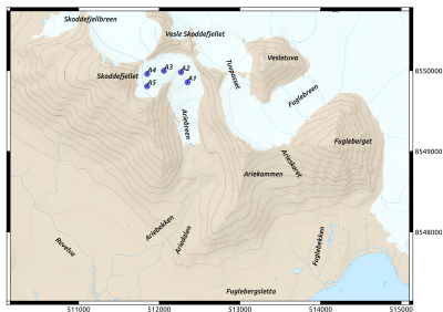
Water samples are collected with the use of an automatic sampler once per day. Their pH, conductivity and chemical composition (major ions) are analysed at the Polish Polar Station Hornsund chemical laboratory. Besides, water temperature and conductivity are measured automatically in situ in the river channels. CT loggers - read monthly / data recording in the 10 minutes timestep. The monitoring programme is running only in the ablation season.

Long-term atmospheric precipitation monitoring in Hornsund region (Fuglebekken)

Contact
Adam Nawrot
anawrot@igf.edu.pl
Info
land platform (fixed)
Operational
No
Geospatial location
POINT (15.54629 77.00576)
6.00
Environment
Since 2004, snow and rain samples have been collected in the Fuglebekken catchment in close vicinity of the Polish Polar Station Hornsund.
Observed Variable(s)
ATMOSPHERE>PRECIPITATION>LIQUID PRECIPITATION>RAIN
rain gauge

The rain gauge is checked approximately once a day.

The rain samples are collected after every rain event.
The pH, conductivity and chemical composition (major ions) are analysed at the Polish Polar Station’s chemical laboratory.

TERRESTRIAL HYDROSPHERE>SNOW/ICE>SNOW/ICE CHEMISTRY
Rain gauge
The rain gauge is checked approximately once a week.
The snow samples are collected after every snowfall.
The pH, conductivity and chemical composition (major ions) are analysed at the Polish Polar Station’s chemical laboratory.

Ariebreen mass balance stake network

Contact
Bartłomiej Luks
luks@igf.edu.pl
Info
land platform (on ice)
Operational
Yes
Geospatial location
POINT (15.48638 77.02833)
400.00
Environment
Ariebreen surface mass balance monitoring reestablished in 2016 and since then is run under the umbrella of Polish Polar Station Hornsund owned by IG PAS.
Observed Variable(s)
CRYOSPHERE>GLACIERS/ICE SHEETS>GLACIER MASS BALANCE/ICE SHEET MASS BALANCE
Stake network is controlled at least twice a year. In Spring: April/May, in the Autumn: September/October
If possible, stake readings are taken twice a year: Spring and Autumn. Bulk snow density measurements are taken in the snow pits

Time-lapse cameras network for sea ice and icebergs monitoring

Contact
Mateusz Moskalik
mmosk@igf.edu.pl
Info
land platform (fixed)
Partly operational
No
Observation Facility ID
10218
Geospatial location
POLYGON ((15.48816 77.01504, 15.73011 77.02586, 15.72957 76.97009, 15.5101 76.97137, 15.48816 77.01504))
8.00
Observed Variable(s)
CRYOSPHERE>SEA ICE>ICEBERGS
In-house developed time-lapse cameras are installed along the coast of Isbjornhamna, on Ariekammen slopes and in front of the Hansbreen.
Imagery is used for calving observation, icebergs tracking and sea ice concentration monitoring. Only raw imagery is avilable.
Additional photos

Time-lapse camera for snow cover extent monitoring

Contact
Bartłomiej Luks
luks@igf.edu.pl
Info
land platform (fixed)
Partly operational
No
Observation Facility ID
10218
6823
Geospatial location
POINT (15.56305 77.01992)
550.00
Environment
The imagery covers the lower part of Fuglebekken catchment and the coastline of Isbjørnhamna
Observed Variable(s)
CRYOSPHERE>SNOW/ICE>SNOW COVER
2014-2017: Harbortronics time-lapse system;
2018 - : Cyclapse
Camera reinstalled at the mounting rack in April/May. Imagery downloaded at the end of the melting season. Imagery is taken every 3 hours. Occasional gaps due to clouds, icing and equipment failure.
Fractional snow cover was processed for the time period: 2014-2016

Hansbreen mass balance stake network

Contact
Bartłomiej Luks
luks@igf.edu.pl
Info
land platform (on ice)
Operational
Yes
Observation Facility ID
11500
Geospatial location
POINT (15.63444 77.05627)
250.00
Environment
Hansbreen surface mass balance monitoring programme started in 1988 on the initiative of the University of Silesia in Katowice. Since the beginning of XXi century programme is run under the umbrella of Polish Polar Station Hornsund owned by IG PAS. Hansbreen (HAB) is a medium-sized (56 km2) tidewater glacier located in the southern part of Wedel Jarlsberg Land, close to the Polish Polar Station in the fjord Hornsund. The glacier is ~16 km long, and elevations extend up to 550 m a.s.l. Surface mass balance monitoring started in 1988/89. Over the period of 1989-2017, the net surface mass balance has been continuously decreasing, with a mean of -0.36 m w.e. a-1. Frontal ablation, measured along the c. 1.5 km long ice cliff shows that mass loss by calving contributes substantially to the total mass loss (23-50%, i.e. additional ablation by an equivalent of c. -0.7 m w.e. a-1 on average) and varies interannually. SMB data are reported on a yearly basis to the World Glacier Monitoring Service.
Observed Variable(s)
CRYOSPHERE>GLACIERS/ICE SHEETS>GLACIER MASS BALANCE/ICE SHEET MASS BALANCE
Stake network is controlled twice a year. In Spring: April/May, in the Autumn: September/October.
Ablation and accumulation measurements are carried out at least once a year. If possible, stake readings are taken twice a year: Spring and Autumn. Bulk snow density measurements are taken in the snow pits. Surface Mass Balance data are reported on a yearly basis to the World Glacier Monitoring Service.
Additional photos

Hornsund Seismological Station HSP

Contact
Kaj Michałowski
kaj@igf.edu.pl
Info
land platform (fixed)
Operational
No
Geospatial location
POINT (15.53318 77.001877)
11.00
Environment
Seismometer placed in the concrete fundament protected by the small wooden house is located in the vicinity of Polish Polar Station in Hornsund.
Seismometer is powered using PSP resources. The data is transfered by cable to PSP and published online in open access catalogues, e.g.: https://ds.iris.edu/mda/PL/HSPB/
Observed Variable(s)
SOLID EARTH>TECTONICS>EARTHQUAKES>SEISMIC PROFILE>SEISMIC BODY WAVES>
Broadband 3 component Streckeisen STS-2 seismometer with sampling rate 100 Hz
https://www.passcal.nmt.edu/content/instrumentation/sensors/broadband-sensors/sts-2-bb-sensor
The position of the instrument should not be changed
Sampling frequency 100 Hz

Weather station Hornsund

Contact
-
-
Info
land platform (fixed)
Operational
No
Geospatial location
POINT (15.541 77.001)
10.00
Observed Variable(s)
ATMOSPHERE>ATMOSPHERIC PRESSURE>SURFACE PRESSURE
Manuel observations and AWS.
Iridium sat every hour.
ATMOSPHERE>ATMOSPHERIC TEMPERATURE>SURFACE TEMPERATURE>AIR TEMPERATURE
Manuel observations and AWS.
Iridium sat every hour.
ATMOSPHERE>ATMOSPHERIC WATER VAPOR>WATER VAPOR INDICATORS>HUMIDITY
Manuel observations and AWS.
Iridium sat every hour.
ATMOSPHERE>ATMOSPHERIC WINDS>SURFACE WINDS>WIND SPEED
Manuel observations and AWS.
Iridium sat every hour.
ATMOSPHERE>ATMOSPHERIC WINDS>SURFACE WINDS>WIND DIRECTION
Manuel observations and AWS.
Iridium sat every hour.
ATMOSPHERE>PRECIPITATION>ACCUMULATIVE CONVECTIVE PRECIPITATION
Manuel observations and AWS.
Iridium sat every hour.
CRYOSPHERE>SNOW/ICE>SNOW DEPTH
Manuel observations and AWS.
Iridium sat every hour.