SIOS actively supports usage of airborne remote sensing platforms (aircraft and drones) for research purposes. The technical and operational details of the available airborne platforms are as follows:
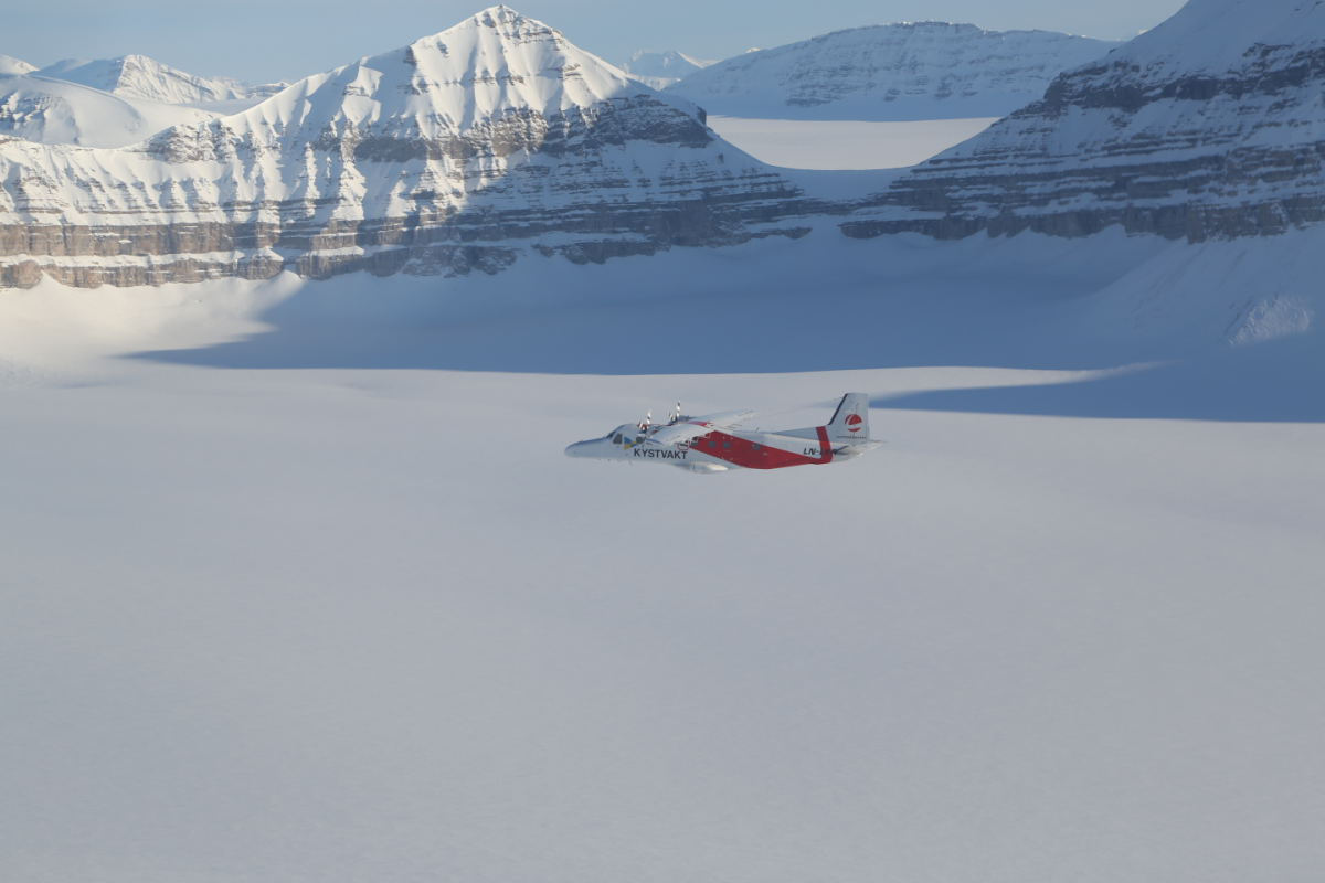
The SIOS Research Aircraft - Dornier 228 LN-LYR
SIOS member institution NORCE has installed and tested a suite of optical imaging sensors on the Lufttransport Dornier aircraft stationed in Longyearbyen, as part of the SIOS-InfraNor project. The aircraft is configured to acquire aerial imagery and hyperspectral remote sensing data in addition to its normal transport operation. The aircraft flies regular flights from Longyearbyen to Ny-Ålesund and Svea, as well as around 20 flights a year to Station Nord in Greenland. The aircraft is also available to charter.
Remote sensing capacities of the aircraft
Optical Payloads:
- Hyperspectral imager with 32 degrees field of view
- VNIR-1800 (https://www.hyspex.com/hyspex-products/hyspex-classic/hyspex-vnir-1800/)
- 1800 spatial pixels, 186 spectral bands in the range 400-1000 nm (~3.26 nm spectral sampling)
- ~600 meter across track coverage from 1000 m altitude, with ~30 cm ground resolution.
- Medium format RGB camera
- PhaseOne IXU-150 RGB camera (https://www.mapping-solutions.co.uk/downloads/data/pdf/PO150.pdf)
- ~800 meter across track coverage from 1000 m altitude.
Other Payloads:
- GNSS Applanix POS AV 410 navigation system.
- Radionor CRE2-179-UAV broadband radio (5.862 GHz)
- Up to 15Mbit/s and 200km range
- Useful for uploading data from buoys and sensor arrays in remote areas
- Kongsberg Seatex AIS-300
- Record and transmit AIS data
Products:
- Georeferenced product
- By proper postprocessing of the navigational data, direct georeferencing with an accuracy of up to 0.5-pixel accuracy is achievable.
Space prepared for future expansion with:
- Hyperspectral (SWIR 900 – 2500nm)
- SAR sensor
- Thermal camera
- Laser scanner
Operational capacities of the aircraft:
- Normal range: 2400 km
- Max endurance: 6:45 hours
- Max take-off mass: 6200 Kg
- Max altitude: 15000 feet
- Cruise speed: 180 knots
- Seat capacity: 2 pilots / 17 passengers
Unmanned aerial vehicle (UAV)/ drones for remote sensing applications
SIOS provides opportunity to use drones funded by the SIOS-InfraNor project, and other drones available with UNIS drone group & NORCE.
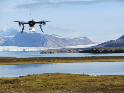
Remote sensing capacities of drones
Drones are equipped with optical imaging sensors – from visible range to infrared. Additional sensor – Intermet iMet XQ2 (sensor including atmospheric pressure, temperature and humidity, GPS coordinates, rechargeable battery and data logger) – can be added to Mavic or Phantom to measure air temperature and humidity profile in atmospheric boundary layer up to 500 m above groundlevel. The ground resolution depends on the height of the multicopter. Each flight session (20 min) can collect up to a few gigabytes (GB) of images (raw data).
List of drones available for operation
| Platform | Sensors | Class | Additional sensors |
|---|---|---|---|
| DJI Inspire 2 | Zenmuse X5 | RO2/RO3 | |
| DJI Inspire 1 | Zenmuse X3 or Zenmuse XT (radiometric) | RO2/RO3 | |
| DJI Mavic 2 Enterprise | Flir + Optic (dual) | RO1/RO2/RO3 | Intermet iMet XQ2 |
| DJI Mavic 2 Enterprise | Zoom lens | RO1/RO2/RO3 | Intermet iMet XQ2 |
| DJI Phantom 4 Pro | Standard | RO1/RO2/RO3 | Intermet iMet XQ2 |
Please contact us if you need more information on usage of drones and Dornier for your project activity.