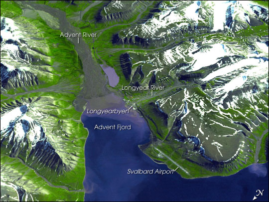
In autumn 2020 SIOS held an online training course on how to effectively use remote sensing data acquired from satellites, from the air or from the ground, and their associated tools and software in the context of terrestrial research in Svalbard. The goal of the course was to teach participants the basic skills needed to work independently to acquire, analyse and visualize terrestrial data sets derived from a variety of close to very long-range sources.
- Time: 31 August - 4 September 2020
- Location: Online
- Recordings: Available
COURSE PROGRAMME AND RECORDINGS
- 31 August 2020
-
Terrestrial Photography I - Video
Roberto Salzano (CNR)Terrestrial Photography II - Video
Roberto Salzano (CNR) - 1 September 2020
-
Close range photogrammetry I & II - Video
Luc Girod (University of Oslo)Europe’s Eyes on Svalbard through the Copernicus Programme - Video
Conrad Bielski (Eoxplore) - 2 September 2020
-
Drones and their applications in Svalbard I & II - Video
Richard Hann (UNIS/NTNU) - 3 September 2020
-
Terrestrial vegetation applications - Video
Hans Tømmervik (NINA) - 4 September 2020
-
Satellite radar interferometry (InSAR) I & II - Video
Tom Rune Lauknes (NORCE)Measuring the surface temperatures of the Earth from space - Video
Darren Ghent (University of Leicester)
GENERAL COURSE INFORMATION
- Target audience
-
Anyone from terrestrial field scientists, Ph.D. students, researchers and technicians with limited or incomplete knowledge of remote sensing techniques.
- Course objectives
-
Objectives
Many field scientists, from SIOS member institutions, have been working on research projects which would greatly benefit from the addition of a richer set of remote sensing viewpoints. However, they may lack the necessary training required to make easy but effective use of freely available data sets, tools, and software, as well as to plan and execute research-grade field remote sensing acquisitions. Ph.D. students from SIOS member institutions who are about to begin careers using remote sensing as an integral part of their research projects can also benefit from this training course.
Topics covered during the training
The training course will include lectures and hands-on sessions focusing on:
- Overview of the range of methods included in the term remote sensing
- Different sensor types (optical, multispectral, thermal, RADAR, LiDAR, etc.)
- Different platform types including handheld/ground (e.g. time-lapse camera, airborne (drone, planes), and satellites
- Overview of available free open-source satellite data (Copernicus satellite and other) and tools that can be used for remote sensing in terrestrial environments of Svalbard
- Examples of applications on glaciers, permafrost processes, snow modelling, terrestrial biology, wildlife monitoring, and more.
- Overview of the range of methods included in the term remote sensing
- Lecturers
-
- Hans Tømmervik (NINA)
- Roberto Salzano (CNR)
- Lars Eklundh (Lund University)
- Luc Girod (University of Oslo)
- Richard Hann (UNIS/NTNU)
- Tom Rune Lauknes (NORCE)
- Darren Ghent (University of Leicester)
- Conrad Bielski (Eoxplore)
- Rasmus Erlandsson (NINA)
- Dariusz Ignatiuk (SIOS-KC)
- Shridhar Jawak (SIOS-KC)


