by William Harcourt, University of Aberdeen
Project Progress Summary
Our BorebreenSurge project (RiS ID: 12213) was successfully carried out between 1st and 14th August as proposed in our original application. We used a set of instruments to measure the active surge of Borebreen on the northwestern side of Isfjorden:
- Seismometers: x29 seismic stations deployed in 5 arrays.
- Drone (Calving Front): x5 drone surveys of the Borebreen ice front.
- Drone (Proglacial Geomorphology): Several drone surveys to map proglacial landforms.
- Terrestrial Laser Scanner (TLS): x3 TLS scans of the Borebreen ice cliff.
Preliminary results are presented below and were presented at Svalbard Science Conference 2023.
Aim 1: Characterise glacier bed conditions during an active glacier surge.
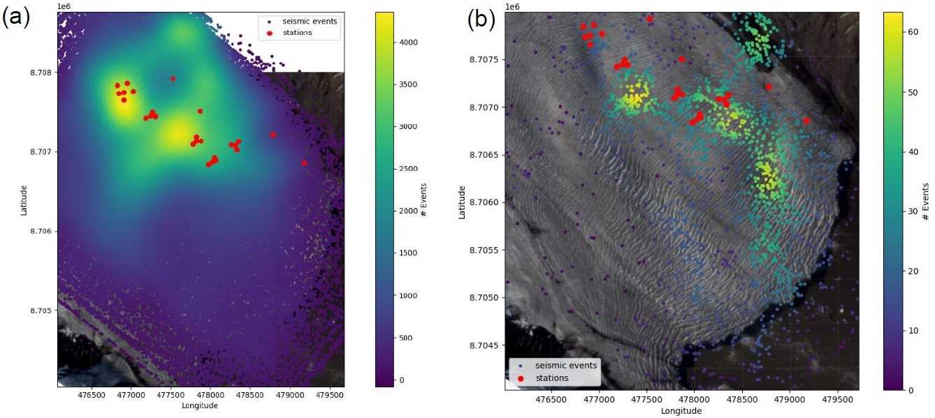
We deployed a network of seismometers on the surface of Borebreen during the first few days of fieldwork (1st-3rd August) and were continuously recording until the final day of fieldwork on 13th August. Preliminary locations of short (below 1s duration) and high-frequency (>20 Hz) events, which represent mostly shallow icequakes (Figure 1a) highlight areas with elevated seismicity. The spatial heterogeneity of events indicates hot spots of seismicity however determining the origin of these events requires further analysis. Long (few to ten seconds), low frequency (2-5 Hz) seismic events (Figure 1b) are located in a few clusters. These signal characteristics would normally fit calving events, but here they point to locations close to the bed. We hypothesise that these events may be affiliated with ice collapses or with glacier sliding, but we exclude typical stick-slip events.
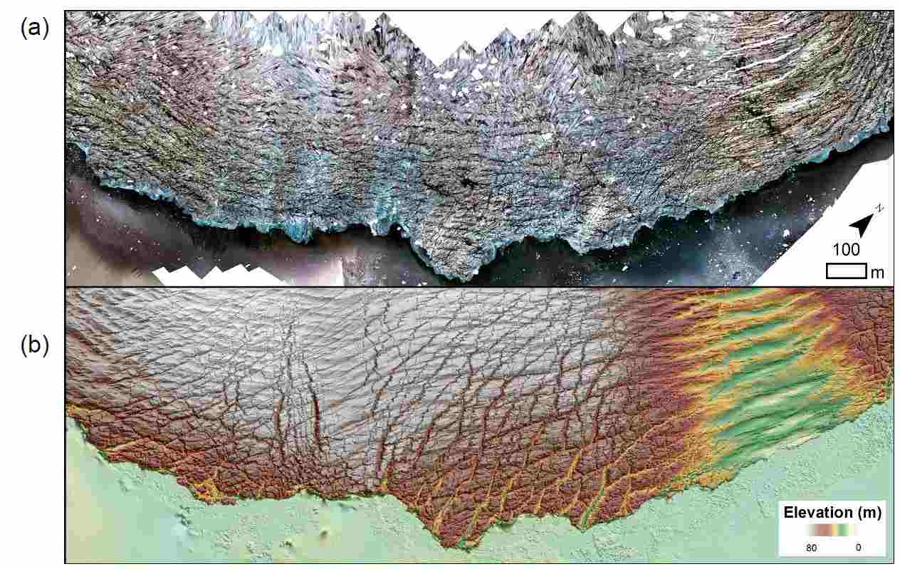
Aim 2: Analyse the impact of an active surge on calving processes.
Drone surveys of the Borebreen ice front (Figure 2) reveal complex, cross-cutting crevasse fields along with a surface depression potentially revealing the presence of a subglacial conduit. The splaying crevasses suggest the ice front is flowing outwards and extending laterally. This is consistent with a surge bulge accelerating from the main body of the glacier. Next steps are to assess elevation changes over time and to align the drone DEMs with the TLS point clouds for full 3D change detection measurements.
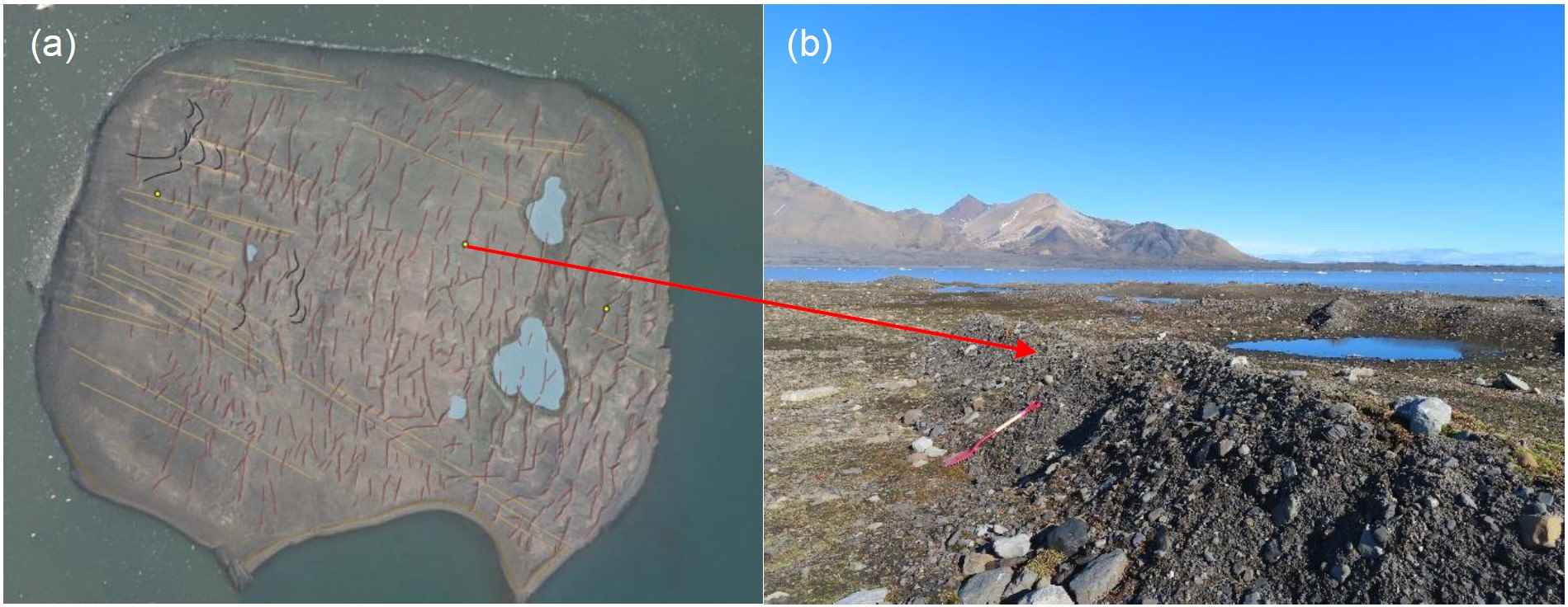
Aim 3: Analyse past evidence for surging through the landform record.
Drone surveys of the proglacial forefield of Borebreen are being used to assess past ice dynamics at Borebreen. Figure 3a shows an example landform map on an island in front of Borebreen and Figure 3b shows an example crevasse-squeeze ridge which is a typical surge-type glacier landform. Additionally, we acquired in situ measurements of particle size, shear strength and compaction.